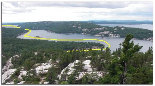
charts & tracks Day 7  July 5th    Mary Ann Cove & Frazer Hill


Frazer Bay Hill Hike
Click to Enlarge


Path to the Top

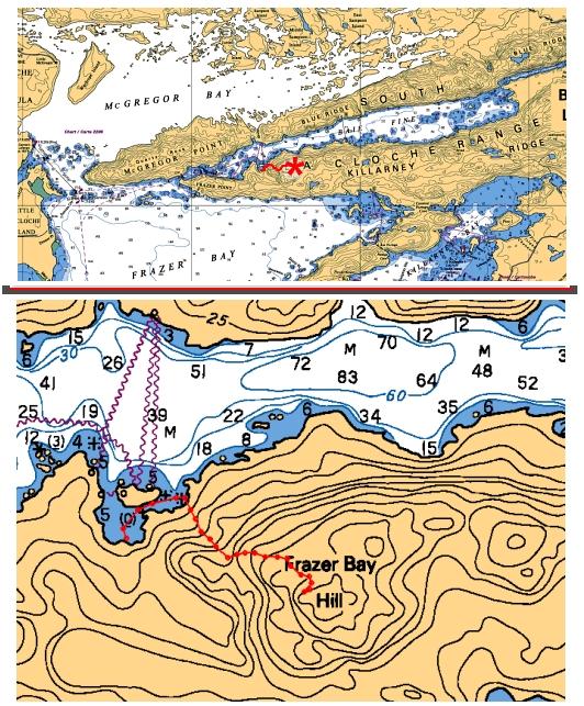
This overview Chart on top shows the general area we hiked. You can see McGregor Bay to the north, Frazer Bay to the southwest, and quite a ways down Baie Fine to the east.


The close up chart below shows our complete route. We start at the boat in Mary Ann Cove, and take the dinghy in the narrow channel between the private island and the shore.

After beaching on shore at the trailhead, we begin our 600 feet vertical climb to the top. The entire trip was not quite a mile.

Mary Ann Cove Anchorage As Seen From Above

View From the Top

Yellow track shows our route from yesterday, as we entered Baie Fine and made our way down to Mary Ann Cove.

This picture was taken from the top of Frazer Bay Hill while on our hike. We couldn't quite see our boats anchored in Mary Ann Cove, but the panoramic view was spectacular. 


Day 7 July 5th  2006 On to Day 8
More Images of day 7 Video from Day 7 Log of Day 7